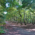
(S) From the car park walk to the road and turn right. Continue down this tarmac track to Haw Park Wood. Enter the wood and take the right path signposted Walton North Trans-Pennine Trail. Turn left at the first track through the woods, 25 metres before the wall and gate of Walton Park Estate. Continue along this woodland track to a large open space where six tracks converge. Take the second right (signposted TPT-horses Walton North). Turn left at the second track through the wood, 170 metres from the clearing. Continue along this track bearing right at each fork to reach an open field. On reaching the field fence turn left to the old Barnsley Canal. Cross a wooden footbridge and turn right to walk along the towpath. After passing under a high stone bridge, double back up the embankment along a path signposted to Anglers Country Park. At the end turn right and continue along the unmade road.
(1) After the road bends right, and becomes tarmac, and before reaching Walton, take the next signposted footpath on the left to Rose Farm. Follow the path to the end of the farm buildings, go left and cross the stile. Follow the route diagonally across the fields to the left extremity of the trees ahead. Continue along the footpath to Common Lane in Walton. Cross the road and turn right for about 200 metres, to a wall stile on your left. Follow this path towards a telecommunications mast on the skyline.
(2) From the mast you emerge into Chevet Lane. Cross over the road and go left for about 90 metres to a wall stile on your right. Cross into an open field and continue to the golf course (Wakefield Golf Club). Cross the golf course with care to reach an enclosed path with high wooden fencing at the entrance. Continue along the hedged path to the end and the houses of Newmillerdam. Bear left, then right to descend steeply downhill to the lake and country park.
(3) Walk along the length of the lake on either side and through the woodland to the very end of the park. Finish at the top left hand corner where you pass through a kissing gate into an open field. Head straight across the field and cross the beck by a stone footbridge, then turn left along its bank. About 100 metres short of some power lines, turn right up the hillside. At the trees, bear left along the path, which soon swings right over an old stone bridge. Follow the path through the middle of the field to a left path which takes you to Notton. Continue on the path which crosses behind the houses to reach a minor road. Turn right, then left at the T-junction to reach Notton village green. (E)

