(S/E) Turn left out of the car park and follow the valley road for a short distance. Cross the footbridge over the River Coquet at the deep pool known as Wedder Leap.
Go through the gate and follow the fence line, on your left, up to the corner of the field. Go through the gate and turn left, walking alongside the tumbled-down wall.
Continue along this sheep path to the Camping Barn and Deer Hut.
(1) Turn right and join the gravel track following it uphill before descending into the valley alongside the Hepden Burn. Climb steeply uphill on the track out of the valley and onto more level ground. Cross the ladder stile and continue straight on the downhill to the Usway Burn. Fairhaugh, originally a shepherd’s cottage, is on the far side.
(2) With the burn still on your right keep following the track around to the left, and head uphill. At the hilltop follow the track right and downhill. Go through the gate out of the forest. After 50metres turn right onto a narrow path which skirts gently around the hillside.
(3) Cross the stile and continue on for 50 metres, then turn left down a sunken grassy track to the Hepden Burn. Cross the burn and go through the gate, following the track uphill to the main forest road. Turn left along the forest road.
(4) At the end of the plantation turn left and go through the gate. After 20metres turn right onto a grassy track and follow this over the brow of the hill. Follow the main track as it skirts left of Barrow Law, and head downhill, passing between two large boulders that were an old field boundary.
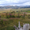
(5) As the track comes over the crest of the hill a lovely view of the Coquet Valley opens up ahead with Barrowburn Farm and Shillhope Law on the left. Keep following the grassy tracks as it winds its way downhill. Go through the gate and, keeping to the path, continue down through the hayfield.
(6) Just before you reach the farm buildings turn sharp right along the track. Go through the gate at the end of the track and turn left onto the road. Follow the road back to the car park. (S/E)


