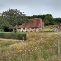
This West Sussex walk explores sections of two long distance trails from Amberley on the banks of the River Arun. The outward leg of the route follows the South Downs Way with the return along a section of the Monarch's Way.
(D)The start and finish point is Amberley station. After crossing the main road and going left under the railway bridge, the first turning on the right leads over a wooden stile to the River Arun. Cross the footbridge over the river on the left and then follow the waymarked signs for the South Downs Way. Once the path gains some height, there is a view looking back towards the River Arun and the footbridge and a stretch of the South Downs ridge to the east of Amberley. After crossing the busy A29 there are no more roads to cross for a few miles as the route heads north-west between fields.
(1)The next dip marks a crossroads of paths near to Westburton Hill and then the next stretch is quite steep going up south west before turning north-west on the way towards Bignor Hill with its two radio stations. Looking back, you can see the path you have just come along across the valley to the east. The path does not go to the top of Bignor Hill but skirts round to the left of it and leads to a car park.
(2)Turn left here off the South Downs Way and head the short distance south to meet the Monarch's Way. Turn left onto this long distance path and continue through woodland along "The Denture" and through Houghton Forest. Once the path crosses the main road (A29) it crosses alongside a field with a view overlooking Amberley.
(3)Rather than walk along the road turn left in Houghton (grid ref. TQ018115) and walk north to rejoin the South Downs Way used earlier. A footpath to the right leads back to the bridge over the river and then back to Amberley railway station.(A)
Waypoints :
D/A : mi 0 - alt. 30ft - Amberley station
1 : mi 1.79 - alt. 420ft - Cross A29
2 : mi 4.23 - alt. 676ft - Turn left off South Downs Way
3 : mi 6.61 - alt. 384ft - Cross A29
D/A : mi 8.73 - alt. 33ft - Amberley station
This route includes parts of both the South Downs Way and the Monarch's Way. The route includes a mixture of fields, woodland, a few hills up and down. After wet weather the paths can be quite muddy. Care is also needed crossing a busy main road. Route finding is generally easy.
Visorando and this author cannot be held responsible in the case of accidents or problems occuring on this walk.
Global average : 4.83/5
Number of opinions : 4
Description quality : 4.75/5
Routemap quality : 4.75/5
Walk interest : 5/5
Global average : 5 / 5
Date of walk
: 13/09/19
Description quality
: Very good
Routemap quality
: Very good
Walk interest
: Very good
It took me 3 hours 45 mins to get back to my car at Amberley station which seemingly has free parking. I made the error of getting back to the busy B2139 heading towards Houghton Bridge on the road . However, after passing the George and Dragon, 60 metres or so I found a footpath shortly after the pub on the opposite side of the B2139 after walking down South Street which rejoined the Monarchs Way in the wrong direction for 30 meteres and then a footpath down to the river bank going correctly North Eastwards and from there I arrived at the bridge which is safe and easy due to several brick built pedestrian safety areas in the structure and from there back to Amberley Station.Lovely walk particularly Houghton Forest on Monarchs Way. But in winter the lower parts will be muddy!
Global average : 5 / 5
Date of walk
: 20/07/19
Description quality
: Very good
Routemap quality
: Very good
Walk interest
: Very good
Very good walk.. Very many cyclist around as well as other hikers.
Very simple to find the route.
Just in the way back, before you arrive to point #3 (A29 in the way back) KEEP LEFT. on the way., as the main way will take you a bit too south. But you need to keep the north side (left).
Have fun
Global average : 5 / 5
Date of walk
: 06/08/18
Description quality
: Very good
Routemap quality
: Very good
Walk interest
: Very good
Loved this walk, good contrast between rural landscapes and canopy woodlands. Lovely!
Thank you for your feedback on this walk. If you have any suggestions on how we can improve the walk description, please let us know!
Global average : 4.33 / 5
Date of walk
: 17/02/18
Description quality
: Good
Routemap quality
: Good
Walk interest
: Very good
Great walk but make sure you take a map with you as there were a couple of bits where it wasn't clear where to go and we did have to refer to our os map a few times to clarify.
But excellent walk with a good mix of views....as description says if it has been rainy it can get quite muddy so don't forget your gaitors!
Starting from Amberley, this West Sussex Walk explores the River Arun visiting the villages of North and South South Stoke. The return route follows sections of the Monarch's Way and the South Downs Way.
This West Sussex walk offers a variety of scenery and includes a section of the South Downs Way National Trail. The route includes a visit to the village of Amberley from where convenient rail services are available.
This West Sussex walk explores the South Downs to the north of Burpham village. Using a mixture of tracks and field paths the route offers some fine views and includes a section of the South Downs Way.
This West Sussex walk starts from Arundel with its Castle, Cathedral and lovely High Street. The route takes you through Arundel Park before dropping down to the path alongside the River Arun for the return to the start.
A linear West Sussex walk from Arundel to Amberley following the course of the River Arun. The return route can be completed using the regular train service.
An easy, varied and beautiful nine-mile walk taking in small paths, Parham House grounds, woodland, Rackham, more woodland, Wiggonholt and Pulborough Brooks. Plenty to see and enjoy
This walk in Slindon Estate is very easy and flat. Slindon Estate is 3500 acres of Sussex woodland, farmland, downland, and pretty villages all divided by paths, hedges, lanes and tracks leading up to the top of the downs.
For more walks, use our search engine.
The GPS track and description are the property of the author.