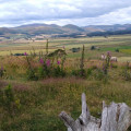
Take an invigorating walk to Cochrane Pike to see some spectacular views. This walk takes you through moorland sheep country surrounded by the sounds of the curlew, oyster catcher, skylark and meadow pipit. You may see buzzard or kestrel, or the recently-arrived red kite in the skies, and the heron in the river valley.
A
Ingram walk
posted on 17/12/19 by Delphinium. Last update : 06/02/23
Description
(S/E) Follow the road from the visitor centre car park heading up to the village hall on the left. Go through the double gates and up the hard track towards Prendwick, as indicated by the fingerpost, keeping the fence on the left.
(1) On crossing the stile next to the field gate follow the hard track around to the right and then left uphill keeping the fence on the left. Continue on the hard track through the field gate and onward to the next field gate and stile at the beginning of Open Access. Cross and head straight up the track to the crest of the hill. As the track forks and the main track continues straight on, take the less obvious route to the right.
(2) Skirt around Wether Hill following the quad track up towards Cochrane Pike. After approximately 250 metres bear right and then continue straight on up to the waymarker post at the summit of Cochrane Pike.
(3) Turn right and head downhill following the narrow path towards the only deciduous plantation which is beyond Little Cleugh. Cross the stile and drop down into the Dene and follow the footpath to another stile on the right. After crossing this stile, follow the very narrow footpath uphill until the fort/settlement is reached. Turn sharp left and follow the footpath up to the stile next to the wicket gate in the corner of the fence. Cross over.
(4) Turn right and follow the quad track, keeping the fence on the right, to a field gate with an adjacent stile. Cross and follow the path across the enclosure. Beyond the corner of the plantation, the wall is another field gate and stile. Cross and carry on down the track through the bracken, keeping the old stone boundary on your right.
(5) Continue on down the hill, following the main track and keeping Turf Knowe on the left. At the bottom turn left on the track down to the valley road, keeping the enclosed field on your right. At the valley, road turns right and carry on through Ingram village. Take the right fork back to Valley Cottage Cafe. (S/E)
Waypoints
- S/E : km 0 - alt. 123 m - Visitor centre car park
- 1 : km 0.41 - alt. 142 m - Stile
- 2 : km 2.26 - alt. 292 m - Wether Hill
- 3 : km 2.9 - alt. 333 m - Cochrane Pike
- 4 : km 3.77 - alt. 273 m - Fence
- 5 : km 4.8 - alt. 239 m - Old stone boundary
- S/E : km 6.84 - alt. 123 m - Visitor centre car park
Useful Information
Car Parking: Ingram Bridge Car Park OS Grid Ref NU 017 163
Toilets: Ingram National ParkVisitor Centre
Terrain: Grass moorland and some short steep slopes
Getting there
The walk start point is 5km/3miles west of the A697 Powburn to Wooler road. Leave the A697 at the junction signed Ingram, 1 mile/1.6km north of Powburn. Follow the valley road for 3 miles, on crossing the River Breamish park in the Ingram Bridge Car Park immediately on the left. To reach the Valley Cottage Cafe follow the signed Woodland Walk through the wicket gate.
Local facilities
The Poacher’s Rest at Hedgeley Services just north of Powburn on the A697 serves food and drink all day. The services have a petrol station and farm shop/butchers - Meat of Excellence. Located in Powburn village, The Plough Inn is a family-run pub serving home-cooked dishes such as fresh trout & game pie.
Refreshments, gifts and information service is available at our National Park Centre, Ingram which is an ideal base for starting out on a number of walks or for just spending a day exploring the valley. The centre is home to a fascinating display of local archaeology with interactive exhibits and examples of Bronze Age pottery.
More information at Northumberland National Park here.
Always stay careful and alert while following a route. Visorando and the author of this walk cannot be held responsible in the event of an accident during this route.


