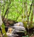
Croy, Mochrum Hill and Culzean Country Park

The walk starts and ends as a beach walk from Croyburnfoot, returning via Culzean Country park. The walk takes in woodland tracks to climb to the summit of Mochrum Hill, which overlooks the county park and gives fine views over the Ayrshire coast and surrounding countryside.

Technical sheet

23726730
A South Ayrshire walk posted on 08/07/22 by ahspence. Last update : 13/07/22
  • Walking
    Activity: Walking
  • ↔
    Distance: 14.93 km
  • ◔
    Calculated time: 5h 10 
  • ▲
    Difficulty: Moderate

  • ⚐
    Return to departure point: Yes
  • ↗
    Vertical gain: + 313 m
  • ↘
    Vertical drop: - 317 m

  • ▲
    Highest point: 264 m
  • ▼
    Lowest point: 1 m
Looking from Mochrum Hill to Ailsa Craig.
Climb to summit of Mochrum Hill
View from summit of Mochrum Hill
Track up to Mochrum Hill

Description

Start : Start from Croy shore. Postcode : KA19 8JS. Grid ref : NS 247 126

(S/E) From the car park, walk along Croy Road as it curves left past Croyburnfoot Caravan Park on your right-hand side. Then walk South along Croy beach in the direction of Culzean Castle.

(1) After 1.5 km along the beach, at Goatsgreen Cottage go inland East onto the road that passes the cottage and head uphill, climbing the locked gate. The track passes through fields and at the junction 400 metres from the beach, turn right, passing a house immediately on the left then another on the right before coming to a crossroads 500 metres from the junction.

(2) Turn left (East) and walk along the track through the woods for 1.4km ((North-East-East) till reaching the A719.

(3) Cross the road and go through the gap in the hedge to the forestry track leading toward Mochrum Hill. 400 metres on, take the track that goes to the left (North-East) and continue for 1 km where the track heads for the B7023.

(4) Before reaching the road, at a junction, turn sharp right (South-West) and walk uphill toward the summit of the hill. There are various paths near the top that lead to the trig point of Mochrum Hill. (A)

On a clear day the views of Culzean Country Park and Turnberry looking toward the coast to the west, Maybole and Ayrshire countryside to the East and North to Brown Carrick hill make the short climb worthwhile.

(5) The descent is about 600 meters West-South-West (you are heading roughly in the direction of Maidens) toward a forestry track which leads through Mochrum woods. You should pass a stone quarry on the right then downhill to reach the A719 coastal road.

(6) Cross the road straight ahead, this takes you out opposite a path leading into the main road entrance to Culzean Country estate. Take the path you feel comfortable walking on to lead (North-West) to either the steps down to the Gas House, behind Culzean Castle or to the steps leading to North Segganwell cottages on the shore.

(7) If you went for the Castle, walk North-East to North Segganwell cottages on the shore. From here it is a 2.24 km walk back along the beach (North-East) past waypoint (1) at Goatsgreen Cottage and back to Croy caravan park and your car. (S/E)

Waypoints

  1. S/E : km 0 - alt. 33 m - Croy shore
  2. 1 : km 1.89 - alt. 6 m - Goatsgreen Cottage
  3. 2 : km 2.92 - alt. 87 m - Junction
  4. 3 : km 4.41 - alt. 123 m - A719
  5. 4 : km 6.04 - alt. 165 m - B7023 - Sharp turn
  6. 5 : km 7.3 - alt. 264 m - Trig point Mochrum Hill
  7. 6 : km 9.82 - alt. 105 m - A719 coastal road
  8. 7 : km 11.88 - alt. 14 m - Steps - North Segganwell cottages
  9. S/E : km 14.93 - alt. 32 m - Croy shore

Useful Information

Start : Start from Croy shore. It follows a part of the Ayrshire Coastal Path.

Car Park
There is parking at the start of the walk At Croyburnfoot. Postcode : KA19 8JS. Grid ref : NS 247 126. You can park at the car park just before Croyburnfoot Caravan Park, or there is parking at the shore, downhill past the caravan park and to the left.

Terrain
The route is mixed, beach, rough tracks, heavily wooded areas, muddy and uneven in parts.
There may be forestry work near Mochrum Hill.

Accommodation :
Croyburnfoot Caravan Park

Always stay careful and alert while following a route. Visorando and the author of this walk cannot be held responsible in the event of an accident during this route.

During the walk or to do/see around

(A) On a clear day the views of Culzean Country Park and Turnberry looking toward the coast to the west, Maybole and Ayrshire countryside to the East and North to Brown Carrick hill make the short climb worthwhile.

[* Culzean Country Park

  • Culzean Castle|https://www.nts.org.uk/visit/places/culzean]

There is a fee to visit this heritage managed by the National Trust.

Other walks in the area

For more walks, use our search engine.

The GPS track and description are the property of the author.

Loading…