A stunning circular route through the idylic South Ayrshire countryside, the Fairy Knowe Trail is most definitely one of Scotland’s hidden gems. The walk follows a variety of forest tracks, mossy tree corridors, and hillside footpaths to reach a viewpoint known as the Fairy Knowe. After a short but steep descent, the track returns to the start following the course of the Water of Gregg.
Description
(S/E) Barr Village Hall (KA26 9TW)
Head East from the parking area opposite Barr Village Hall.
At a bend in the road keep right to continue ahead (South East) onto Changue Road, passing Barr Primary School.
(1) Approx 1.7km along from the start you will reach a fork at a way marker – take the path on the right to ascend South then West towards a forest.
(2) After a further 1km, look out for a way marker which indicates a left (East) turn off the main track onto a mossy/grassy track. Enjoy a very pleasant stroll along this tree-lined footpath and on emerging from the forest after 1km the view opens up revealing the Fairy Knowe down below on your left-hand side.
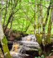
(3) Follow a grassy path ahead and downhill to cross a footbridge with a nice waterfall beneath it.
(4) Follow the path onto the hillside, steadily ascending to the viewpoint atop Fairy Knowe.
(5) Follow the granite steps down the steep slope to a bridge across Laggan Burn then turn left (West) when you reach the forestry track.
Continue on this forestry track beside the Water of Gregg for approx 1.4km to return to the way marker from earlier (1), and retrace your steps along Changue Road which will in turn lead you back to Barr Village Hall (S/E)
Waypoints
- S/E : km 0 - alt. 105 m - Barr Village Hall
- 1 : km 1.7 - alt. 150 m - Fork at way-marker
- 2 : km 2.66 - alt. 225 m - Left turn off main track
- 3 : km 3.87 - alt. 214 m - Footbridge with waterfall
- 4 : km 4.14 - alt. 189 m - Fairy Knowe viewpoint
- 5 : km 4.33 - alt. 183 m - Bridge
- S/E : km 7.57 - alt. 105 m - Barr Village Hall
Useful Information
For more info and a walk report visit Gillian's Walks.
Walk can also be started from the Barr Trails Car Park, just off Changue Road (KA26 9TT) which shortens it by around 2km.
Amenities
- Toilets inside Barr Village Hall
- If you contact the Village Community Association in advance, food/refreshments can be arranged for groups of walkers. Call 01465 861 062 or contact the village Facebook page.
Always stay careful and alert while following a route. Visorando and the author of this walk cannot be held responsible in the event of an accident during this route.
During the walk or to do/see around
- Barr Trails - There are many other walking trails to try all starting from Barr Trails Car Park. Each one is way marked using different coloured arrows.


