Harthope Valley

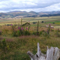
A lovely family walk following the Harthope Burn before a moderate climb opens up the area, offering spectacular views to the top of the valley and the Cheviot Hills, as well as to the coast. The Harthope Valley is the starting point for many inspiring walks up onto the Cheviot Hills.

Technical sheet

2821788
A Earle walk posted on 19/12/19 by Delphinium. Last update : 06/02/23
  • Walking
    Activity: Walking
  • ↔
    Distance: 5.78 km
  • ◔
    Calculated time: 2h 05 
  • ▲
    Difficulty: Easy

  • ⚐
    Return to departure point: Yes
  • ↗
    Vertical gain: + 154 m
  • ↘
    Vertical drop: - 153 m

  • ▲
    Highest point: 303 m
  • ▼
    Lowest point: 147 m
  • ⚐
    District: Earle 
  • ⚑
    Start/End: N 55.51856° / W 2.039019°

  • Today’s forecast: … Loading…

Description

(S/E) Start the walk by following the road over the metal bridge, crossing the Carey Burn. Keep following the road up the valley with the Harthope Burn on your left.

(1) Turn left off the road and follow the stone track. Cross the burn and continue on the track up towards Langlee Cottage.

(2) Just before the cottage follows the path round to the left, keeping the fence on your right. Go through the wicket gate which leads out onto the moorland. Follow the path for a short distance until it joins the grassy track. On joining this track turn left and head uphill.

This hill section is a bit of a climb so stop for a rest and turn around to look back at the views up the valley to Cheviot on the right (2674ft/815m) and Hedgehope (2342ft/714m) on the left.

(3) At the junction of paths at the top of the hill turn left.

(4) As the main track continues round to the right and begins to climb uphill take the grassy track down to the left. Continue to follow this track downhill, keeping the fence/wall on your right.

(5) Cross the stile and turn left. At the corner of the fence, turn left and follow the path along the valley side. This section of the path can be muddy.

(6) Cross the footbridge, go through the wicket gate and turn right onto the road and return to your car. (S/E)

Waypoints

  1. S/E : km 0 - alt. 149 m - Car park
  2. 1 : km 2.27 - alt. 203 m - Stone track
  3. 2 : km 2.45 - alt. 193 m - Langlee Cottage
  4. 3 : km 3.51 - alt. 298 m - Junction
  5. 4 : km 3.98 - alt. 285 m - Grassy track
  6. 5 : km 5.01 - alt. 158 m - Stile
  7. 6 : km 5.52 - alt. 156 m - Footbridge
  8. S/E : km 5.78 - alt. 150 m - Car park

Useful Information

Park on the wide grass verge on the right, just before the metal bridge that spans the Carey Burn (NT976250).

More information at Northumberland National Park here.

Always stay careful and alert while following a route. Visorando and the author of this walk cannot be held responsible in the event of an accident during this route.

Reviews and comments

Other walks in the area

For more walks, use our search engine.

The GPS track and description are the property of the author.

Loading…