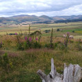
(S/E) Start from outside the Village Hall, turn left along the main road. Cross over the road bridge, and take the footpath on the left, (signed ‘Hethpool’) crossing over the stile. Follow the path up the field to the ladder stile on the left.
(1) Cross the stile and turn right. Follow the track down to the haughland (flat grassland beside a river). Turn right along the haughland, after approx 200m the path bears right away from the river. Go through a gateway and follow the track uphill, then through a gate at the top of the bank, and over to a ladder stile in the wall ahead.
(2) Go over the stile and follow the path as it contours around the hill just above the trees on your left. Cross the stile into the woodland, and walk down the well worn path. At the bottom of the hill turn right and carry on, keeping the fence on the left, to reach a stile.
(3) Cross the stile, turn right and carry on up a gentle slope and over another stile. Continue on for a short distance, at the junction turn left taking the path down to the footbridge. Hethpool Linn waterfall is well worth taking a look at.
(4) Cross the footbridge, and turn left. Go over the stile and turn right uphill.
(5) At the junction turn left, (you are now on St Cuthbert’s Way) follow the path down through the gorse, over the burn, up the other side and over the stile. Look out for the wild Cheviot goats here, they offer no threat to walkers if left alone. Continue uphill along the grassy path to the square stone stell (a roofless stone shelter for sheep). Join the farm track and follow it uphill to the wooded area. Carry on along this track through the trees and past Torleehouse.
(6) Continue along the track, just before the dry stone wall and cattle grid turn right up to the field gate. Once through the gate follow the track to the ladder stile. Cross the stile and turn right and continue up the well worn path.
(7) At the junction turn left along the footpath signed ‘Yeavering Bell.’ Follow the path down through the heather. Cross the burn and keep to the obvious path as it winds its way to the summit of Yeavering Bell.
(8) Explore within the tumbled ramparts of Yeavering Bell hillfort. Here are the remains of the largest Iron Age hillfort in Northumberland. At the bottom of the hillfort, the Anglo-Saxon kings of Northumbria maintained a grand palace (Gefrin). Much earlier, Neolithic people had a temple here. Yeavering Bell hillfort today consists of a tumbled stone rampart, originally up to 2.5 metres high, which encloses an area of 5.6 hectares, within which are the still visible outlines of about 125 timber-built roundhouses.
(9) Walk to the opposite side of the hillfort and go through the large gap in the stone ramparts. Bear left to zig zag down the hill following the well worn path (take care it is quite steep here). Cross the stile and follow the path alongside the wall down to the next stile. Once over this stile continue on through the field turning left to join the farm track which leads towards the hamlet of Old Yeavering.
(10) Cross the ladder stile, and turn left up the road and away from Old Yeavering.
(11) After the second cattle grid leaves the road and turn right over the ladder stile. Continue up the field to the gateway in the wall. Go through the gate and turn right onto the grassy track. Keep to this track and follow it downhill to the stile by the road. Cross the stile and turn left along the road back to Kirknewton. (S/E)


