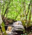
(S/E) Leave the car park from the main entrance, cross Kirkmichael Road and turn left (North West). Almost immediately take the road on your right (North East) signposted Fowler’s Croft.
Walk along this residential street passing some pretty cottages on your left-hand side and a small burn on your right-hand side.
(1) At the end of the road follow a narrow track straight ahead along the edge of some trees (path not shown on map). You will emerge onto B741/Dalmellington Road.
Turn left (East) and walk along the roadside for 240m before turning left again (North) to cross a stone bridge onto a minor road.
(2) The road heads uphill past Hazel Lodge, just beyond which there is a fork. Keep left (North).
(3) Follow this track uphill. You will pass another cottage, beyond which the track turns grassy. Eventually you will arrive at the edge of a forest and here you turn left (NW) onto a wide grassy clearning in the trees (boggy underfoot at the time of writing and somewhat overgrown in summer months).
Stay on the main forestry track ignoring any off-shoots.
(4) After approx 2.5km you will emerge at a gate. Go through the gate and turn left (South) to follow a track downhill to Altizourie farm. Turn right outside the farm house. This road leads you to the B7045/Kirkmichael Road.
Crossing the road, continue almost straight ahead (West) onto a gravel track.
(5) Soon after passing Bishopland Lodge, turn left (South) at a fork and after 340m you will reach a gate at the entrance to a field. Note the Water of Girvan on your right-hand side!
Continue straight ahead to cross the field using quad tracks on the edge of the slope. The tracks fairly closely follow the field boundary fence all the way to a metal gate leading into another field on your right.
(6) Go through the gate then continue straight ahead (SE) along faint tracks on the edge of the slope. The ground is quite tussocky here and hard going. The tracks lead you to a gate with "Private Garden" signage on it - here veer left up the hillside, roughly following the field boundary fenceline.
(7) You will begin to see a gate ahead. Go through the gate and follow the track straight ahead to reach the B7045.
Turn right (South) along B7045, then take the second road on the right (W) at the Lady Hunter Blair shelter.
(8) Walk along this road to reach The Old Bridge of Blairquhan over the Water of Girvan. Cross the bridge then turn left (South).
You will reach a crossroads at the B741. Continue straight ahead (South).
Take the first road on your left (East), signposted Bennan Farm. Stay on this road until you have passed through Bennan farm (ignore an earlier marker post pointing to the car park, unless you want to take a short cut!).
(9) Turn right when you reach the farm cottage, then just before the field turn left (East) onto a track. Follow this around the edge of some paddocks, emerging onto Newton Stewart Road.
Turn left (North) onto Newton Stewart Road and when you reach the war memorial turn left (North West) onto Main Street/B741.
Walk through the village to reach the car park, 400m along on the left-hand side (S/E)


