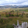
A great way to see the spectacular remains of a 2,000-year-old Iron Age hillfort in breathtaking surroundings. A nice moderate walk where you can spot a Cheviot goat or two, then enjoy a pot of tea or pint of beer in Kirknewton having lapped up some significant ancient history.
(D/A) Start at St Gregory’s church - the heart of the village for more than 800 years. Follow the track through the village, past the Old Smithy. Keep to the track following it uphill past the ruined shepherd's cottage on your left.
(1) Keep to the left track, as it curves around the hillside to the sunnier southern side of West Hill. People have probably lived here for over 5000 years. You can see that the ground is marked by ridge and furrow and other signs of early field systems.
(2) Follow the track through a gate and continue past the ruined cottage on your left, to a stile. Cross the stile.
(3) Take the path on the left up to the top of West Hill where you will find the remains of an Iron Age hillfort. Retrace your steps from the top back down to rejoin the main path at point (4). Hillforts were built by Ancient Britons over 2000 years ago during the Iron Age. Each had ramparts of earth or stone enclosing an area where timber roundhouses once stood. At West Hill, you can see the footings of stone roundhouses built during Roman times, long after the hillfort was abandoned.
(4) If you do not want to climb West Hill take the path to the right and follow it to the stile at the head of the field wall by the burn. From here you can either take the path back down to Kirknewton, joining onto the main track that you came up and turning right, back to the village.
(5) Or you can climb St Gregory’s Hill where you will find the ramparts of another hillfort. The ramparts on this hillfort were more elaborate on the side facing West Hill, perhaps to impress the neighbours!
(6) Come down the hill along the waymarked track around St Gregory’s Hill, and return to the village along the road. (D/A)
Waypoints :
D/A : mi 0 - alt. 207ft - St Gregory’s church
1 : mi 0.66 - alt. 318ft - Hillside
2 : mi 1.38 - alt. 518ft - Gate
3 : mi 1.58 - alt. 535ft - West Hill
4 : mi 2.19 - alt. 472ft - Stile
5 : mi 2.39 - alt. 558ft - St Gregory’s Hill
6 : mi 2.61 - alt. 568ft - Back to the village
D/A : mi 3.38 - alt. 203ft - St Gregory’s church
Getting there: Kirknewton is 6 miles north west of Wooler. Follow the A697 north, at Akeld turn left onto the B6351 which goes through Kirknewton. Please park carefully on the roadside verge. Please do not block any gates or the road.
Parking: Kirknewton Village Hall.
Terrain: Footpaths and tracks, may be muddy, some short steep inclines.
Note: This trail follows permissive footpaths across working farmland, please keep to the path.
Local Services: Wooler and Milfield.
Nearest Toilets: Kirknewton Village Hall.
Visorando and this author cannot be held responsible in the case of accidents or problems occuring on this walk.
Local Facilities: The village of Kirknewton lies at the head of the River Glen, which is formed by the confluence of two rivers - the College Burn and Bowmont Water. There are no services in the village. Milfield, 4 miles northeast has a Country Café and Store whilst Wooler, 6 miles east has a wider range of services including petrol, doctors and small supermarket as well as a Tourist Information Centre (TIC) in the Cheviot Centre.
The National Park Centre at Ingram has refreshments, gifts and local tourist information, it is also an ideal base for starting out on a number of walks. The centre is home to a fascinating display of local archaeology with interactive exhibits and examples of complete Bronze Age pottery vessels excavated from the Breamish Valley. Entry is free.
Local History: Look inside St Gregory’s Church, in Kirknewton, for its greatest treasure, a twelfth century carving of the Adoration of the Magi. Notable people buried in the churchyard include Josephine Butler (1828 - 1906) the Victorian campaigner for women’s rights, and Alexander Davison (1750 - 1829) a close friend of Admiral Lord Nelson. There are also memorials to twelve British, Canadian and New Zealand airmen killed in the Cheviots during the Second World War.The obelisk on the hill across the valley was built by Alexander Davison’s son William as a memorial.
West Hill and St Gregory’s Hill overlook Kirknewton village and have both been the subject of recent surveys by English Heritage.
They are attributed to the Iron Age, though there is no absolute dating evidence available for either. You can find out more about hillforts and the people who lived in them from the Cheviot Centre (TIC) in Wooler and from the National Park Centre at Ingram.
Wildlife: Look out for the wild Cheviot goats roaming the surrounding hills, they can usually be seen near Yeavering Bell. You may also see hares lying low in the long grass as you walk up the hillside. Kestrel can often be seen hovering overhead whilst buzzard circle high in the sky. Skylark and curlew can be heard and seen on the hillsides.
A lovely walk to Hethpool Linn waterfall, on the College Burn, then a climb up Yeavering Bell (Hill of the Goats) with a chance to spot some wild Cheviot goats.
Take an invigorating half day’s walk to the top of Yeavering Bell – The Hill of the Goats. The walk offers stunning views from the top and if you are lucky you may be able to spot some of the wild Cheviot goats along the way. The hilltop is very exposed to poor weather so please go prepared.
A lovely family walk to Hethpool Linn, a dramatic waterfall on the College Burn, returning along St Cuthbert’s Way - we can’t guarantee it, but a good vantage point to see the wild Cheviot goats.
Enjoy a short walk to two of the hillforts in the College Valley. The climb up to Great Hetha is well worth the effort for the views into the Cheviots.
A great route that introduces the walker to the tranquil College Valley. Look out for the Wild Cheviot Goats on the hillside near Hethpool Mill.
A lovely family walk following the Harthope Burn before a moderate climb opens up the area, offering spectacular views to the top of the valley and the Cheviot Hills, as well as to the coast. The Harthope Valley is the starting point for many inspiring walks up onto the Cheviot Hills.
A short Northumberland walk that offers some great views south to the Cheviot Hills. Doddington Moor is home to a stone circle and many ancient cup and ring markings on stones spread across the area.
This walk in the Northumberland National Park follows the England-Scotland border fence and starts from Kirk Yetholm. The walk uses the Pennine Way to reach Black Hag. The return route follows an alternative route of the Pennine Way back to the start.
For more walks, use our search engine.
The GPS track and description are the property of the author.