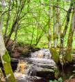
Lady Hunter Blair’s Walk, Straiton
One of those hidden gems Ayrshire has to offer! This is an easy walk starting in the village of Straiton and taking you into a wooded glen to visit some surprisingly spectacular waterfalls.
Description
(S/E) Leave the car park from the main entrance, cross Kirkmichael Road and turn left (North West). Almost immediately take the road on your right (North East) signposted Fowler’s Croft.
Walk along this residential street passing some pretty cottages on your left-hand side and a small burn on your right-hand side.
(1) At the end of the road follow a narrow track straight ahead into the trees (path not shown on map). You will emerge onto B741/Dalmellington Road.
(2) Turn left (East) and walk along the roadside for 750m. Shortly after passing a farm road on your right, you will come to a small parking area on your left-hand side (The walk can be shortened and the B road avoided by parking here).
You will see a footpath leading through a dry stone wall to a picnic bench. From the picnic bench follow the track right (North East) - only shown on OS map - which will lead you into the woods and past a series of lovely waterfalls. The Lambdoughty Burn should be on your left-hand side.
(3) After approx 500m cross a footbridge and follow the footpath (not shown on map) West along the other side of the burn, this time with several sets of steps and footbridges keeping things interesting.
(4) Eventually the path reaches it’s lowest point at a large footbridge and starts to head quite steeply uphill back to the picnic bench (2).
From here retrace your steps back to the car park (S/E)
Waypoints
- S/E : km 0 - alt. 109 m - Car park off Kirkmichael Road, Straiton (KA19 7NF)
- 1 : km 0.29 - alt. 112 m - Narrow track leading to B741, not shown on map
- 2 : km 1.15 - alt. 157 m - Small parking area
- 3 : km 1.73 - alt. 184 m - Footbridge
- 4 : km 2.24 - alt. 150 m - Footbridge
- S/E : km 3.45 - alt. 109 m - Car park off Kirkmichael Road, Straiton (KA19 7NF)
Useful Information
For more information and a walk review visit Gillian's Walks
Transport
- Car park off Kirkmichael Road, Straiton (KA19 7NF)There is an information board in the car park and some leaflets about walks in the area. (The walk can be shortened and the B road avoided by parking at (2))
- Local bus service stops on Main Street, 1 minute from the walk start point
Terrain
A mixture of tarmac roads and woodland footpaths. Several sets of steps.
Always stay careful and alert while following a route. Visorando and the author of this walk cannot be held responsible in the event of an accident during this route.
During the walk or to do/see around
- Village of Straiton - public toilets, cafe, shop
- Straiton - "Ramblers Territory" - there is a network of walking trails in the area and leaflets/maps can be obtained from the information board at the car park. You can also visit the Gillian's Walks website and search for 'Straiton'.


