Start The Little Mill Inn, Hollinsmoor Road, Rowarth, High Peak SK22 1EB (Tel: 01663 747678)
(S/E) From the front of the Little Mill pub, turn left. Just beyond the car park, turn right along a concrete drive past two houses. Pass Brookside Cottage on your left at the end of the drive and continue along the rocky path
beyond until you reach the village green in the centre of Rowarth.
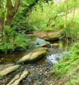
(1) Take the footpath on the right, beside the old telephone box. Follow the footpath down to and along the stream. When you reach a stile into a concrete track by a ford, cross a second stile opposite and continue along the left-hand bank of the stream beyond. At a footbridge, keep straight on, until you reach a stony track.
(2) Turn right to a ford (with a slab bridge to the left). Follow the track beyond, past a ruined farm building, until it meets the road. Follow the road ahead, past Kings Clough Head Farm, ignoring a footpath sign on the right.
(3) Turn right onto a track followed by the Pennine Bridleway. Go through a gate at a right-hand bend and continue to Matley Moor Farm, then keep on along the track ahead past Bullshaw Farm.
(4) At a meeting of six paths, go through a gate on your right and then head diagonally across the field, aiming just left of the highest ground (signposted “PENNINE BRIDLEWAY Hayfield 2½”). In the far corner of the field, go through the gateway and follow the walled track beyond. By a National Trust sign, take a path uphill through the heather on your right and follow it to the topograph at the summit of Lantern Pike. Beyond the summit, follow the ridge as it descends to a wall.
(5) Turn sharp left and follow a stony path downhill alongside the wall to return to the Pennine Bridleway. Turn right and follow the track, which shortly joins a metalled driveway and leads steeply downhill to Sitch Lane. Turn right and follow the road to its summit, at the entrance to Wethercotes Farm on your right. Keep along the road as it heads downhill.
(6) Pass a footpath sign on your right, then turn right into the drive to Bank Head Farm. Walk through the farmyard, then go through a field gate on your right. Turn immediately left and follow the wall. At an isolated farmhouse, cross a stile on your left and pass in front of the house. Aim half-right across the next field towards the cottages at the far side.
(7) At the metalled driveway by the cottages, turn left and walk past Aspenshaw Hall. Shortly before you reach the public road, take a footpath on the right up a short flight of steps. Cross a stile and follow the footpath beyond, along a wall at the bottom of a wooded bank. Beyond the wood, continue along the sunken wall to Thornsett Fields Farm, where there is an awkward stone stile down to the farmyard.
(8) Walk past the farmhouse. Beyond the farmyard, which may be muddy, follow a footpath straight ahead across fields until you reach a road. Turn left and walk down the lane to the Little Mill Inn. (S/E)

