(S) Head south along the unnamed minor road to reach a bridge over the River Ayr.
(1) Cross the bridge then just before reaching the A70, turn left (East) through a kissing gate. The path leads you across a wooden footbridge and into some trees, running parallel to the A70 to another kissing gate further along.
Take care crossing the A70 and pick up the continuation of the trail at the other side of the road (South East). The path heads into the trees then bends left and runs behind the tree plantation, meeting up with the River Ayr again close to the A70.
The next section hugs the river on a grassy footpath – a beautifully scenic and tranquil area.
(2) After 2km the path begins to veer away from the River Ayr. It bends to the right along a fenceline and joins up with another track.
(3) Turn left (East) onto the track.
(4) At a crossroads next to Upper Wellwood farm, turn right (South West).
(5) You will soon reach a fork in the path - turn left (North East) along a disused railway track bed.
(6) At the bottom of some steps turn right (South East) onto a wider, gravel track.
(7) You are only on this track for 130m before there is a fork, keep left (East).
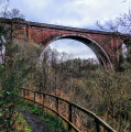
(8) 270m along this path you will reach Tibby’s Brig.
(9) At the other side of the bridge the path heads uphill and onwards to a fork. You can continue along the River Ayr Way (avoiding the hike up Cairn Table and cutting out 4.5 miles) by turning left (North) here – it takes you directly to Kames Racetrack. To include the Cairn Table hike, turn right (South) at the fork and follow a grass and gravel footpath along a fence line for approx 0.8 miles (1.3 km), passing MacAdam’s Stone along the way.
(10) After 1.5km, turn left onto a fairly indistinct trail up the hillside through heather and tussocky grass.
(11) At 498m of elevation, you will arrive at the main "tourist" path to the summit - turn right (South East) to continue uphill.
(12) 700m (and 100m ascent) later, you will reach the large cairn on top of Cairn Table.
Start your descent via the same path, heading north west for 700m. Keep right at the fork (11) to pass the track by which you ascended and continue downhill for 3km in a north-westerly direction.
You will pass some brick fortifications and a stone ruin before emerging at the walkers car park at Kames.
(13) Walk through the car park then just before you reach the road, turn right (North East) to follow the directional arrows for the River Ayr Way. This takes you onto a footpath between two fence lines.
(14) Turn left (North) at a fork 300m along.
(15) A further 1km along this path you will reach a minor road. Turn left (North) and at the end of the road turn right (South East) onto another road.
(16) 100m along this road look out for a River Ayr Way wooden marker post on your left
Go through the kissing gate and follow grass and gravel footpaths along a disused railway track bed for 4.7km, eventually emerging onto the A70.
(17) Cross the A70 carefully to another kissing gate directly across the road and turn right (East) along a path running parallel to the A70 behind a row of trees. The path ends on the minor road at Glenbuck Loch. Turn left (North) along the road.
(18) After 160m turn right (North East) onto another road leading towards a cottage. Pass through the gate (ignore the “Private Property” signs – this is the official River Ayr Way route) and continue along this road gently uphill to a small parking area.
(19) In the parking area you will find the Glenbuck Sculpture as well as the information board marking the official start point of the River Ayr Way. If you have time, I can recommend exploring the woods here and the path which heads down to the banks of Glenbuck Loch where there is a bird hide and information centre.
If you are parked at the Glenbuck Heritage Village, retrace your steps to the cottage/gates with the private property signs (18) and turn right (North) onto the road.
Follow this road uphill for approx half a mile / 700m to the car park at Glenbuck Heritage Village (E)


