Rowarth Brook

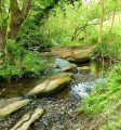
An easy stroll along a pretty stream valley known locally as Little Switzerland.

Technical sheet

24411753
A New Mills walk posted on 25/07/22 by Walks from the Door. Last update : 26/07/22
  • Walking
    Activity: Walking
  • ↔
    Distance: 1.97 km
  • ◔
    Calculated time: 0h 40 
  • ▲
    Difficulty: Easy

  • ⚐
    Return to departure point: Yes
  • ↗
    Vertical gain: + 50 m
  • ↘
    Vertical drop: - 50 m

  • ▲
    Highest point: 254 m
  • ▼
    Lowest point: 204 m

Description

Start: The Little Mill Inn, Hollinsmoor Road, Rowarth, High Peak SK22 1EB (Tel: 01663 747678)

(S/E) From the front of The Little Mill Inn pub, turn left. Just beyond the car park, turn right along a concrete drive past two houses. Pass Brookside Cottage on your left at the end of the drive and continue along the rocky path beyond until you reach the village green in the centre of Rowarth.

(1) Take the footpath on the right, beside the old telephone box. Follow the footpath down to and along the stream. When you reach a stile into a concrete track by a ford, cross a second stile opposite and continue along the left-hand bank of the stream beyond. At a footbridge, keep straight on, until you reach a stony track.

(2) Turn left and follow the rocky bridleway up the slope. When you meet a metalled driveway, turn left and follow it downhill back to Rowarth village. Turn left at Anderton House and retrace your steps along the Brookside Cottage bridleway back to the Little Mill Inn. (S/E)

Waypoints

  1. S/E : km 0 - alt. 204 m - The Little Mill Inn
  2. 1 : km 0.37 - alt. 217 m - Rowarth Village Green
  3. 2 : km 0.95 - alt. 237 m - Stony Track
  4. S/E : km 1.97 - alt. 204 m - The Little Mill Inn

Useful Information

Start: The Little Mill Inn, Hollinsmoor Road, Rowarth, High Peak SK22 1EB (Tel: 01663 747678)

Note: One gentle climb and two or three stiles; wet grass and mud after rain.

Refreshments: Available at The Pub.

Find more information on Walks From the Door website here.

Always stay careful and alert while following a route. Visorando and the author of this walk cannot be held responsible in the event of an accident during this route.

Other walks in the area

For more walks, use our search engine.

The GPS track and description are the property of the author.

Loading…