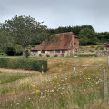
An easy, varied and beautiful nine-mile walk taking in small paths, Parham House grounds, woodland, Rackham, more woodland, Wiggonholt and Pulborough Brooks. Plenty to see and enjoy
Mill Lane car park is the closest from the starting point.
(D) From Storrington bus station, start walking head south to A283 and cross to Church Street, which becomes Greyfriars Lane. Walk to the end of Greyfriars Lane using a farm track until you reach Kithurst Park/Lane.
(1) Take a sharp left to Kithurst Park. At the junction with Amberley Road, cross carefully the road and turn right. After a few meters, look for a small path to your left.
(2) Turn left and follow the path until you hit the A283/Pulborough Road in Cootham.
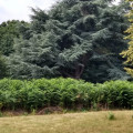
(3) Turn left and follow the West Sussex Literary Trail which is going through Parham House & Garden. There is some truly spectacular trees in the grounds and you may see deer and geese.
(4) Take the path on the right and keep following the West Sussex Literary Trail until you reach Rackham Street.
(5) Turn left on Rackham Street, pass some houses on your right and then, turn right at the car park. At the end of the small forest, turn left.
(6) Turn left through the fields and woods on Rackham Road.
(7) Turn left on Rackham Street, walk back to (5) and continue straight until you hit Greatham Lane. Cross it carefully to join the smaller path you see in front of you. It's tarmac for about a mile and a half to the footpath, but the route is through lovely woodland.
(8) From here, follow the path bearing left at the fork, which is heading to the RSPB Pulborough Brooks. After you pass it, head north and keep the river to your left until you will arrive in Pulborough (A).
Waypoints :
D : mi 0 - alt. 128ft - Storrington bus station
1 : mi 1.67 - alt. 177ft - Kithurst Park
2 : mi 1.98 - alt. 151ft
3 : mi 2.51 - alt. 98ft - Pulborough Road
4 : mi 3.04 - alt. 161ft
5 : mi 3.88 - alt. 59ft - Rackham Street
6 : mi 4.84 - alt. 89ft - Rackham Road
7 : mi 5.44 - alt. 30ft - Rackham Street
8 : mi 6.95 - alt. 89ft
A : mi 8.55 - alt. 62ft - The White Horse pub and bus stop - The White Horse
Visorando and this author cannot be held responsible in the case of accidents or problems occuring on this walk.
This West Sussex walk explores sections of two long distance trails from Amberley on the banks of the River Arun. The outward leg of the route follows the South Downs Way with the return along a section of the Monarch's Way.
Starting from Amberley, this West Sussex Walk explores the River Arun visiting the villages of North and South South Stoke. The return route follows sections of the Monarch's Way and the South Downs Way.
This West Sussex walk offers a variety of scenery and includes a section of the South Downs Way National Trail. The route includes a visit to the village of Amberley from where convenient rail services are available.
This West Sussex walk explores the South Downs to the north of Burpham village. Using a mixture of tracks and field paths the route offers some fine views and includes a section of the South Downs Way.
This West Sussex walk starts from Arundel with its Castle, Cathedral and lovely High Street. The route takes you through Arundel Park before dropping down to the path alongside the River Arun for the return to the start.
A linear West Sussex walk from Arundel to Amberley following the course of the River Arun. The return route can be completed using the regular train service.
A nice variety - up high on the Downs, and back down to woodland, countryside, riverside - with Chanctonbury Ring frequently in view in the distance.
For more walks, use our search engine.
The GPS track and description are the property of the author.