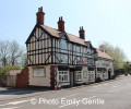
This historical walk is part of the Bicentennial walk (2017), Pentrich and South Wingfield Revolution Group. It starts in South Wingfield and finishes in Giltbrook. This is Walk 19 of the Pentrich and South Wingfield Revolution group.
Start : South Wingfield
(D/A) From The Yew Tree (opposite William Turner’s house) in South Wingfield, walk past Wingfield Manor.
(1) Then go down the hill to Coalburn Farm, passing Coalburn Quarry.
(2) Walk on through Wingfield Park, along the minor road to Beech Hill Farm, one of the farms visited by the rebels.
(3) Continue past two others, Lodge Hill Farm and Wingfield Park Hall, cross the River Amber, to reach the Pentrich Mill near Pentrich Lane End.
(4) Crossing the road follow the path up the hill to Pentrich Church. Cross the graveyard, turn right in Pentrich, pass the Dog Inn.
(5) Pass the Dog Inn, and walk down the road to Home Farm on your right.
(6) Take the track to the left, and take the first footpath to the left, cross the fields to drop down to the course of the former Cromford Canal. Here turn left and walk on to the road.
(7) Go under the A38, turn left to follow the footpath down to the Midland Railway Station.
(8) Cross the tracks and go on to Butterley Reservoir. Go on with the reservoir on your left until reaching the unpaved road, turning left to follow it up to Derby Road, to face the former Butterley Ironworks. Here the rebels confronted George Goodwin demanding arms and weapons.
(9) Turn right to go up Butterley Hill towards Ripley. After going under the A610 bypass, opposite the Out Of Town public house, take the footpath marked to Carr Wood. Follow this to come out at Greenwich (A) roundabout at Sainsbury’s supermarket.
(10) Turn left to go to the next roundabout on the A610, and crossing the road, take the footpath past the playing field and on behind the Codnor Gate Industrial Estate. Where the path divides take the path on to the right, continuing to follow the fence down the side of the industrial estate.
(11) Reaching the Swanwick Road from Codnor, turn right and follow the road up the hill. Turn right at the footpath sign and walk on to the A610 road. Turn left to walk on up Glasshouse Hill, passing the site of the former Glasshouse pub that the rebels visited, and on to Codnor Market Place (B).
(12) From French Horn (C), follow the A610 (Nottingham Road) South-East out of Codnor, on the Woodlinkin bypass, to the turning to the right to Langley Mill.
(13) Pass through Aldercar, where houses and farms were visited for men and weapons, and continue on the road through Langley Mill to reach the Great Northern pub (called the Junction Navigation in 1817) next to the canal basin. Here the marchers also stopped for refreshment in 1817 and one marcher shot by accident.
(14) From the Great Northern pub return to the canal, crossing the bridge and go under the bridge by the canal to walk along the Erewash Canal.
(15) Cross the second canal bridge (No.26) and walk ahead to reach a bridge over the A610. Cross to continue on up the hill through Old Eastwood, with the Sun Inn ahead. The marchers also stopped at the Sun Inn.
(16) Turn right and follow the Nottingham Road through Eastwood, continuing on it through Hill Top and
Newthorpe and drop down the hill into Giltbrook. The marchers stopped to rest at the former Tanyard, now part of the IKEA site. Continue to the roundabout at the entrance to IKEA where the marchers are confronted by a body of soldiers at Giltbrook and fled. (D/A)
Waypoints :
D : mi 0 - alt. 397ft - The Yew Tree
1 : mi 0.86 - alt. 322ft - Coalburn Farm
2 : mi 1.22 - alt. 387ft - Wingfield Park
3 : mi 2.46 - alt. 387ft - Lodge Hill Farm
4 : mi 3.07 - alt. 269ft - Pentrich Mill
5 : mi 3.94 - alt. 433ft - The Dog Inn
6 : mi 4.12 - alt. 417ft - Home Farm
7 : mi 4.86 - alt. 354ft - A38
8 : mi 4.96 - alt. 344ft - Midland Railway Station
9 : mi 5.58 - alt. 354ft - Butterley Hill
10 : mi 6.46 - alt. 479ft - Sainsbury’s supermarket
11 : mi 7.79 - alt. 377ft - Swanwick Road
12 : mi 8.32 - alt. 407ft - French Horn
13 : mi 10.35 - alt. 289ft - Aldercar
14 : mi 11.64 - alt. 213ft - Great Northern pub
15 : mi 11.95 - alt. 203ft - Erewash Canal
16 : mi 13.25 - alt. 325ft - The Sun Inn
A : mi 14.95 - alt. 223ft - IKEA Giltbrook
Care needed when crossing roads. Undulating, footpaths, stiles, lanes and roads.
More information at the Pentrich and South Wingfield Revolution Group here.
Alternative starts : This walk is part of the Bicentennial walk (2017), Pentrich and South Wingfield Revolution Group. Alternative starts are available from South Wingfield, Pentrich, Alfreton, Swanwick, Ripley and Heanor :
Visorando and this author cannot be held responsible in the case of accidents or problems occuring on this walk.
If you are curious about how the map of the area was around 1817 click here.
(A) Greenwich - This is where the men from Ripley met up with the marchers avoiding the town centre and the awaiting constables
(B) This is where the men from Alfreton and Swanwick met up with the min group in 1817, the Alfreton men met up with Swanwick marchers en route. Here all of the groups merged coming from South Wingfield, Pentrich, Alfreton, Swanwick, Ripley and Heanor. After a rest and having refreshment in the Poet and Castle (former New Inn) and French Horn (then on the other side of the Nottingham Road), both visited by rebels on the night of 9th/10th June 1817, all the marchers met up and continue together towards Nottingham.
(C) This is where the men from Heanor met up with the main group, they travelled from Heanor to Codnor using the main road through Loscoe
This walk visits sites associated with the story of Pentrich and South Wingfield Revolution. Home of many of the rebels and starting point for their march following previous protests at low wages, Luddite attacks, rick burning, and reform, support for the Hampden Club. This is Walk 2 of the Pentrich and South Wingfield Revolution group.
The walk will visit places in and around Pentrich and the Amber Valley which remind us of the impact of the June 1817 ‘Pentrich Revolution’ on people's lives one year after the Rising. This is Walk 20 of the Pentrich and South Wingfield Revolution group.
This walk visits sites associated with the story of Pentrich and South Wingfield Revolution. After leaving South Wingfield, on the night of the 9th June 1817, the rebels passed through the Fritchley area, visiting farms to demand weapons and men as they marched towards Nottingham. Retrace some of their steps on this walk and discover some anecdotes about that period. This is Walk 3 Fritchley from the Pentrich and South Wingfield Revolution Group.
This circular route starts from The Dog Inn and follows parts of the Pentrich and South Wingfield Revolution story. The largest community in the area in 1817, Pentrich was the centre of planning for the rebellion in Derbyshire. En-route see the commemorative plaques placed by the Pentrich Historical Society. This is Walk 5 of the Pentrich and South Wingfield Revolution group.
This walk visits sites associated with the story of Pentrich and South Wingfield Revolution. Alfreton, an historic town recorded in the Domesday Book, was an important centre in 1817, as a crossroads for the Turnpike roads between Chesterfield, Derby, Nottingham, and the High Peak, and centre of the most important coal mining area in the county. This is Walk 6 of the Pentrich and South Wingfield Revolution group.
An easy walk in the countryside around Alfreton and Oakerthorpe area going through fields and bluebell woodlands with nice views onto Amber valley.
This walk visits sites associated with the story of Pentrich and South Wingfield Revolution where many joined the rising from the Swanwick area, where discontent among miners and framework knitters had already been expressed in Luddite activity and an active Hampden Club. The walk will also pass the interesting industrial heritage of the area. This is Walk 7 of the Pentrich and South Wingfield Revolution group.
This walk visits sites associated with the story of Pentrich and South Wingfield Revolution. Walking from the Derwent Valley into Amber Valley and the events of the 1817 Pentrich Rising. This is Walk 21 of the Pentrich and South Wingfield Revolution group.
For more walks, use our search engine.
The GPS track and description are the property of the author.