(S/E) Turn left at lake out of the park gate, by the lodge. Cross road, go up school hill behind Fox & Hounds Public House. After 100 metres turn left between gap in wall onto limestone track. Veer left where tarmac road meets the limestone path, follow track up the hill.
(1) At road turn left. Go straight across mini roundabout and past Bay Horse Public House. Opposite dwelling known as Hall Croft follow footpath to Seckar Wood.
(2) Where second hedgerow crosses the path, turn right following left hedgerow towards houses. Follow field around to the left. Before field curves to left, cross over railway sleepers on right to follow alongside woodland.
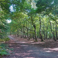
(3) After 30 metres turn left over wooden bridge, then immediately left again into woodland. Take path on the right up the hill, keeping the open field on your right. Keep on this track which bears left into the woodland. It should be well waymarked, until you come to a flight of steps.
(4) At the top of the steps turn left to reach the main track (watch out for rabbit holes!). This leads to a wider track. Turn left down hill into woodland, continuing straight ahead past the ponds on your right. This track leads to Barnsley Road. Turn right at Barnsley Road then left at the next intersection and then right
(5) Just before bridge turn left up the steps. Turn left at the top. After 50 metres turn right down the hill and follow track ahead of the beck. Follow track around to left, keeping beck on right. After 150 metres turn right over bridge then left along field boundary, keeping the beck on your left.
(6) After about 50 metres cross field towards white square sign (this is the right of way which crosses private farmland). Follow track straight ahead into the park. Ignore first track on left.
(7) At the fork, turn left down the hill. At the main track turn left over the bridge then right. Follow this track back to the car park.(S/E)


